A Student-Built Fire Detection System Combines Learning and Community Service
Developed in the School of Engineering labs, the tool has already shown promising potential and was well-received by the Lebanese Civil Defense.
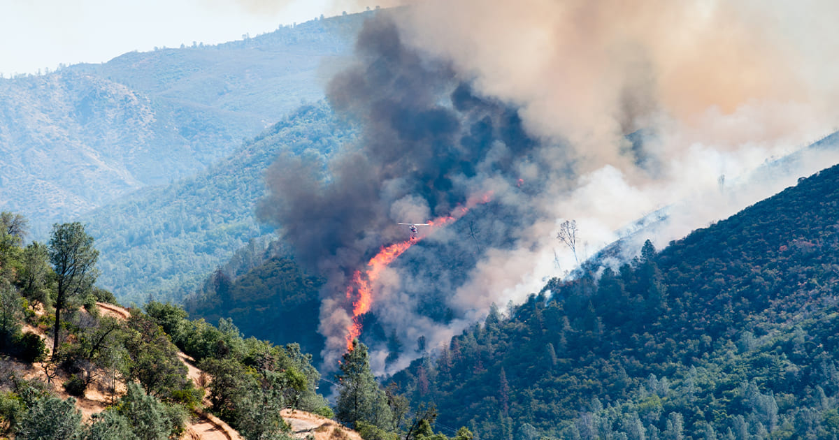
Since 2019, Lebanon has recorded an increase in the incidence of wildfires, underscoring a worrying trend for the country and the region. Against this alarming reality, the LAU School of Engineering (SOE) mobilized its students to create an automated fire-detection platform that can contribute to reducing first responders’ response time and, consequently, the scope of damage.
A team of four students—electrical engineering student Joya Maria Saade, mechatronics majors Christopher Zein and Georges Barhouche, and computer engineering student Joey Angelil—spent the summer developing this platform under the mentorship of the SOE’s associate professors Zahi Nakad and Gilbert Accary.
The team completed Phase 1 of the project in a short span of 10 days. They managed to build a fire-detection dashboard that utilizes satellite data from two systems: The EUMETSAT, a geostationary satellite that reports every 10 minutes, and NASA Firms, a three-satellite constellation that can cover Lebanon several times a day.
Local municipalities and first responders are then notified through instant messaging that includes the location, fire-intensity indicator and a link to the LAU dashboard for visualization. This level of detail in reporting can ensure that even early-stage fires do not go unnoticed.
The beta version of the system has been delivered to the Lebanese Civil Defense, officially launching what Dean Michel Khoury hopes will become a long-standing, mutually beneficial partnership.
“Graduating civically engaged engineers who offer their knowledge and skills to the service of their community and the country is at the core of our philosophy at the school,” said Dr. Khoury.
The data collected from the satellites will be projected on an interactive map that displays ongoing fires in real time, allowing first responders to judge the level of severity and certainty, explained the students.
In the near future, Angelil hopes to be able to “enhance the platform in terms of accuracy, using our own image-processing technology to make it as advanced as possible.”
More specifically, the team’s objectives for Phase 2 include enhancing image processing, daytime smoke detection and coarse geostationary resolution to optimize timeliness and reduce false positives. Other areas for improvement entail adding a dashboard for municipalities to alert staff members, as well as preparing a secure digital hosting plan.
For Saade, the opportunity to work on this project was very rewarding, as it allowed her to advance her skills while doubling as “a means of helping the community.”
Stressing the collaborative nature of the project, Zein noted that the team is made up of different engineering disciplines, combining electrical, mechatronics and computer engineering. “Faculty and students put their diverse skillsets forward, working side-by-side to come up with this advanced-level solution,” he said.
Ultimately, Barhouche was delighted to finally see the project coming to fruition in Lebanon, where forests make up a large percentage of the landscape and wildfire risk is on the rise.